Photo
John Clark Madison
Photo
Sorn Castle
| AYRSHIREHISTORY.COM PRESERVING THE PAST . . . . FOR THE FUTURE |
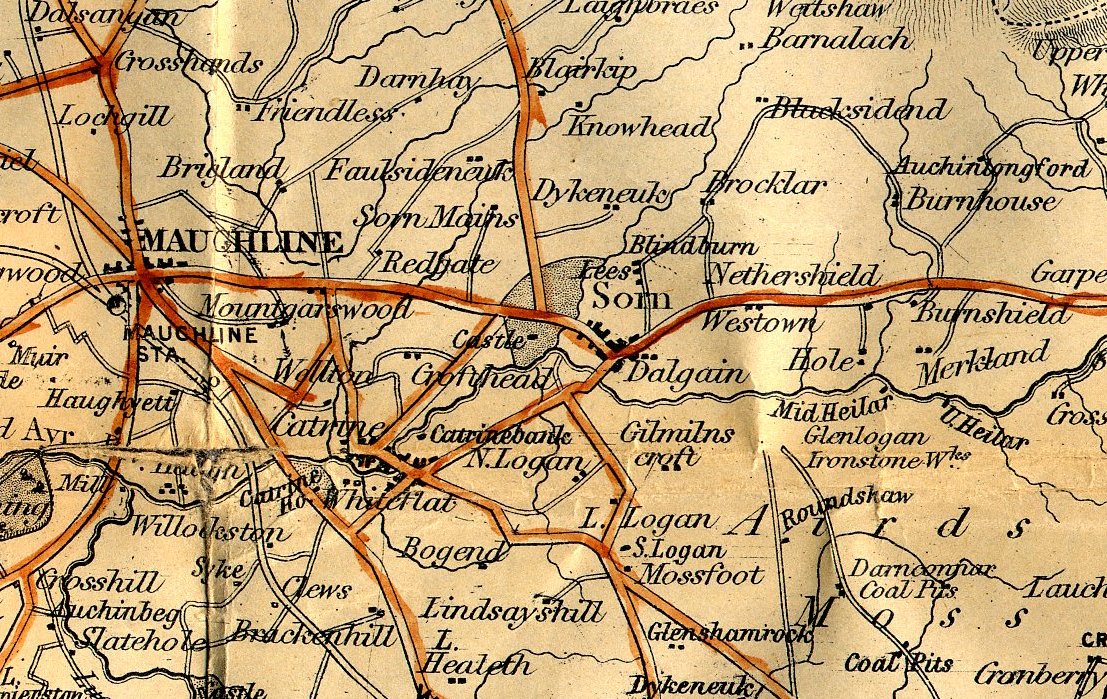
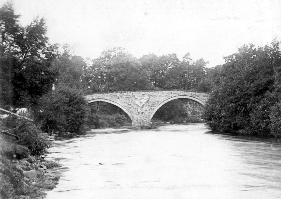
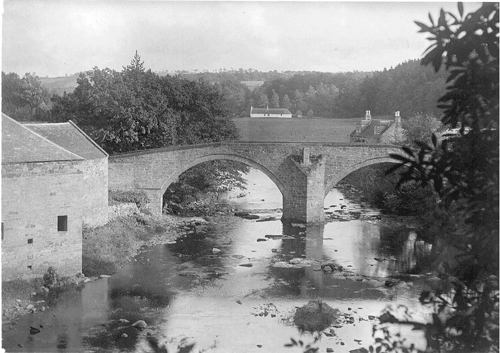
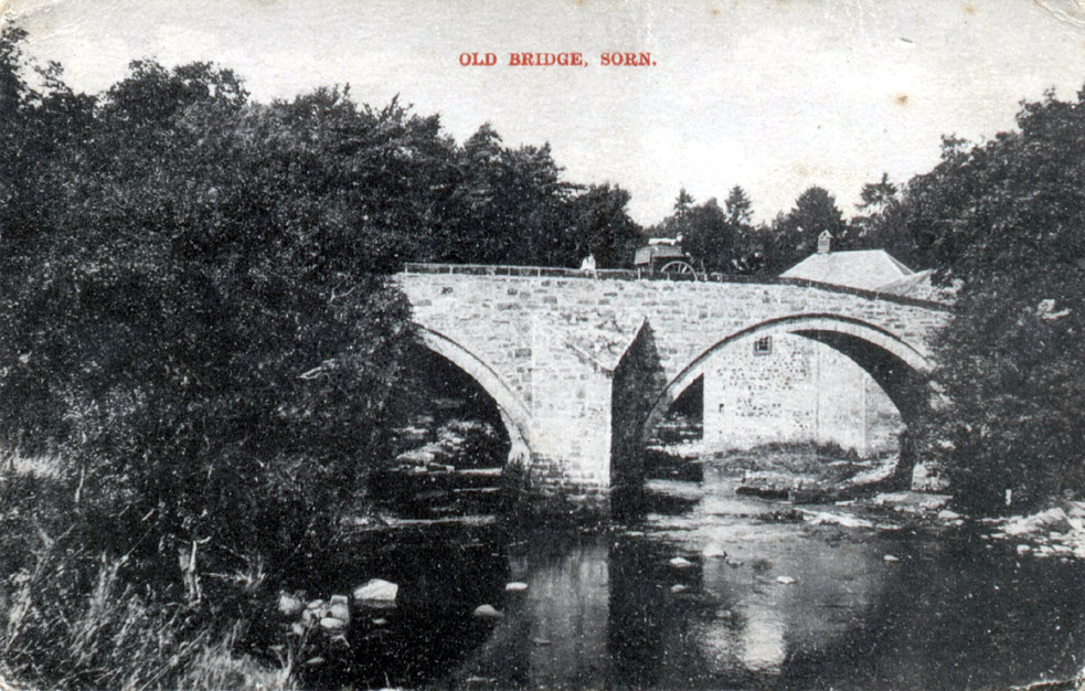
SORN |
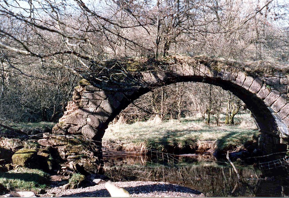
Sorn "Auld Brig"
|
|
Photo
John Clark Madison |
Photo
Sorn Castle |
|
The
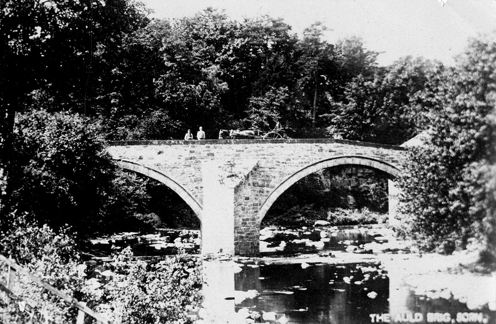
"Auld Brig" by the church, built in the reign of Rev Steel 1736
- 1751. The money was raised by the Minister and the bridge built to prevent any more accidents at the ford. Quoting 'Sorn, The Village on the Green', "Mr Gibson told me that it was a minister, the Rev William Steel, who caused the bridge to be erected in the late eighteenth century, after one of his parishioners had been drowned fording the swollen river on his way to worship". |
 |
 |
Photo
Jean McKay |
Photo Terry Harrison |
|
Left: A 1923 postcard
of Sorn Auld Brig. |
Sorn "New Brig"
 |
 |
|
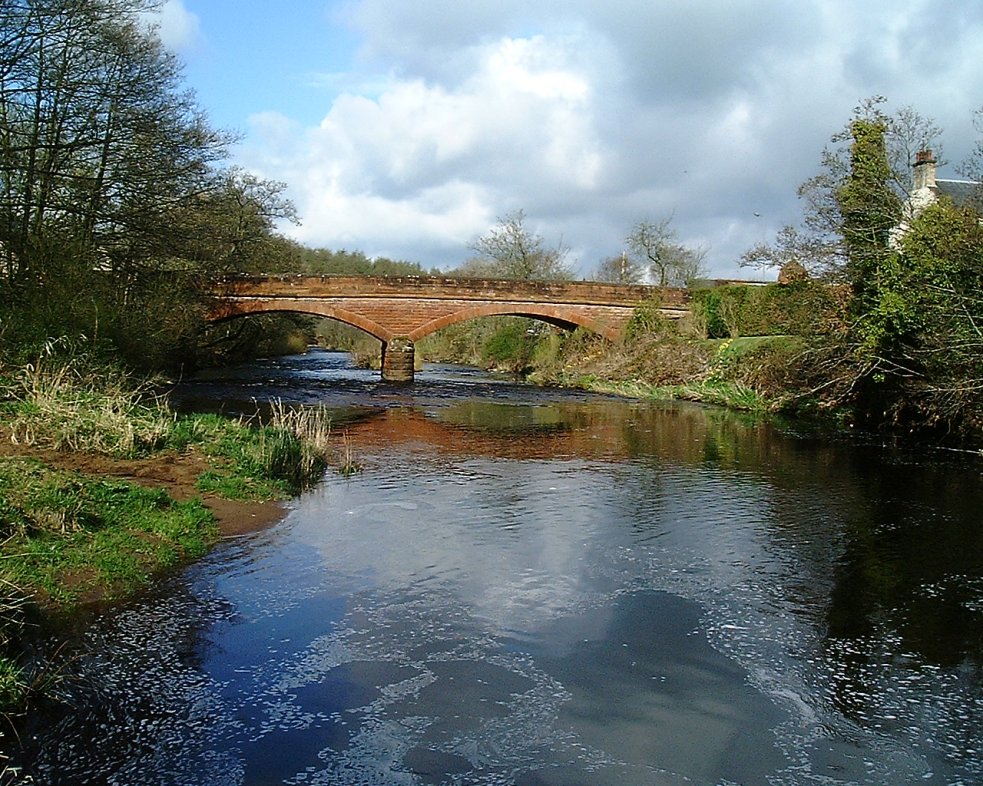
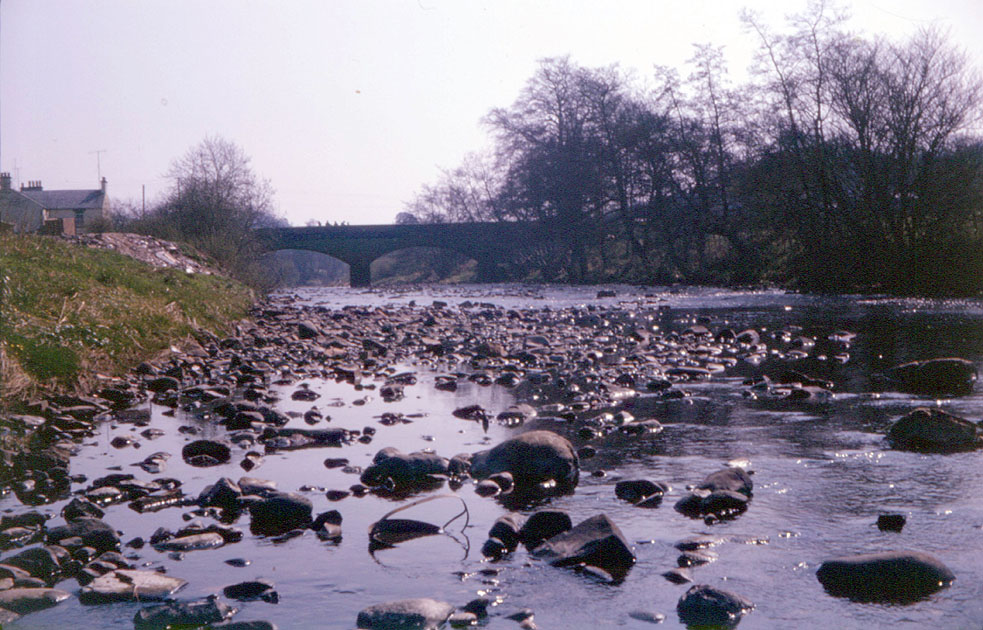
Left:
The New Bridge, or Brig as it is called locally, is not really new.
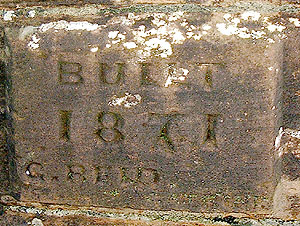
Built in 1871 by Reid, as per plaque on the west face, it was built
to replace the ford at Coalford. Because Coalford was the Post Office
in the latter half of the 20th century, and in fact until 2002, the
bridge was also called The Post Office Brig. Seen here looking
west in April 2004 on the left, and looking east on the right, during
the 60s. Right: The river bed as it was in the 60s, including Sandbed rubble, and the stones. There is virtually no island here on the west side of the bridge compared with what we see today. |
 |
Burn O' Need Bridge
Photo
David Templeton
|
The Burn O' Need bridge, is on the old road which winds through the back woods between Sorn Mains and Brigen'. There is no archway left now, but many of the stones are still lying in the burn. I was down a walk in August 2009, and decided it was time to put the old photo on line. I did not have a camera with me that day for an up to date photo. The bridge was still up in the 1980's. This was part of an old roadway, long since forgotten. Does anyone know for sure if it was part of an old "Edinburgh Road"?? I seem to recall being told this at the time I borrowed the photo, although an old map from Gall & Inglis seems to suggest it was simply the old road into Sorn Mains. |